




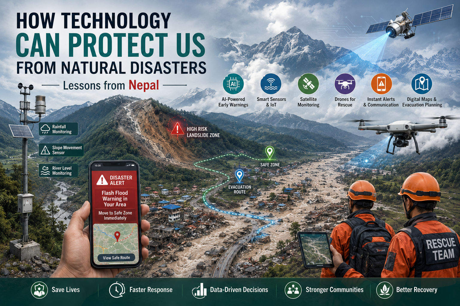
Natural disasters cannot always be prevented, but technology can help us predict risks, issue warnings earlier, protect critical infrastructure, locate survivors and coordinate rescue operations faster.
The devastating disaster that struck Nepal in August 2026 is a powerful reminder of this need. A catastrophic debris flow and flash flood in the Himalayan region followed rapid slope failure, causing widespread destruction. Reports indicate that hundreds of people have died and thousands remain missing, while roads, bridges, power infrastructure and other critical facilities have been destroyed.
The tragedy raises an important question:
Can technology help us save lives before a disaster becomes a catastrophe?
The answer is yes—but only when technology is connected to strong infrastructure, local communities and an effective emergency-response system.
1. AI-Powered Early Warning Systems
One of the biggest opportunities is the use of Artificial Intelligence (AI) for disaster prediction.
AI can analyse enormous amounts of information from:
- Weather stations
- Satellite imagery
- River-level sensors
- Ground-movement sensors
- Rainfall measurements
- Seismic activity
- Glacier and snow data
- Historical disaster records
Researchers have already been testing AI-based landslide warning systems in Nepal that combine rainfall, ground movement, local observations and satellite imagery to identify potential landslide risks.
Imagine a system that detects:
Heavy rainfall + unstable mountain slope + increasing ground movement + rising river level
The AI could automatically classify the area as Low, Medium, High or Critical Risk.
Authorities could then evacuate vulnerable communities before the landslide or flood occurs.
2. Smart Sensors in Mountains and Rivers
Thousands of low-cost IoT sensors could be installed in disaster-prone regions.
For example:
Mountain sensors
→ Detect ground movement
→ Detect cracks
→ Measure soil moisture
→ Monitor slope stability
River sensors
→ Measure water level
→ Measure flow velocity
→ Detect sudden changes
Glacier sensors
→ Monitor glacier movement
→ Detect formation of unstable lakes
→ Monitor temperature and water levels
When unusual changes are detected, the information can be transmitted to a central disaster-management platform in real time.
Nepal already has experience with flood, landslide and glacial-lake-outburst early-warning systems, providing a foundation on which more advanced technology can be built.
3. Satellite Technology: Seeing Disaster Zones from Space
Satellites can become the “eyes in the sky” during a disaster.
Satellite imagery can help authorities identify:
- Newly formed lakes
- Glacier movement
- Landslides
- Flooded areas
- Destroyed roads
- Isolated villages
- Damaged bridges
- Changes in river channels
This becomes particularly important in mountainous regions where rescue teams may not be able to physically reach an area.
In the recent Nepal disaster, satellite observations have been particularly valuable because unstable lakes and difficult terrain created additional risks for rescue teams.
4. Drones for Search and Rescue
Drones can reach places that helicopters or rescue teams cannot immediately access.
Equipped with:
- High-resolution cameras
- Thermal cameras
- Night-vision systems
- GPS
- AI-based image recognition
drones can search large areas for survivors.
An AI system could analyse drone video and identify:
Human body → possible survivor → GPS location → rescue team notified
Drones can also create updated maps of destroyed roads and bridges, helping emergency planners determine which routes remain usable.
Research on disaster management has already identified drones as valuable tools for monitoring, mapping and damage assessment during floods and landslides.
5. Smartphone-Based Emergency Alerts
Early warning is useful only if people actually receive it.
A modern disaster-warning platform should send alerts through multiple channels:
SMS + Mobile App + Cell Broadcast + Siren + Radio + TV + WhatsApp/Internet
This is important because mobile networks may fail during a major disaster.
An emergency message could say:
CRITICAL FLOOD WARNING
Flash flood expected in your area. Move immediately to the designated evacuation zone. Do not cross rivers or bridges.
The system should also provide the nearest safe location and evacuation route.
6. Digital Maps and Evacuation Planning
GIS (Geographic Information Systems) can create detailed disaster-risk maps.
Authorities can digitally identify:
- Flood-prone villages
- Landslide-prone slopes
- Hospitals
- Schools
- Shelters
- Roads
- Bridges
- Power stations
- Water supplies
- Emergency warehouses
When a disaster occurs, the system can automatically calculate:
Which areas are affected?
How many people are there?
Which roads are blocked?
Where are the nearest hospitals?
Where should rescue teams go first?
This can dramatically improve the efficiency of emergency operations.
7. AI-Based Missing-Person Systems
One of the most painful aspects of a major disaster is the inability of families to locate their loved ones.
A centralized Disaster Missing-Person Platform could combine:
- Aadhaar/passport or other verified identity information
- Emergency registrations
- Hospital records
- Shelter registrations
- DNA information
- Facial recognition, where legally permitted
- Survivor reports
- Last-known GPS information
Families could search for a missing person through a secure platform instead of contacting dozens of agencies individually.
This could be particularly valuable in disasters involving tourists and international travellers.
8. Communication When Mobile Networks Fail
Communication infrastructure is often one of the first things to be damaged.
Therefore, disaster-prone areas should have backup communication systems such as:
- Satellite phones
- Satellite internet
- Emergency radio networks
- Portable communication towers
- Mesh networks
- Drone-based communication relays
A village cut off by a destroyed bridge should still be able to communicate:
“We are safe. We need food, medicine and evacuation.”
That single message can save lives.
9. Digital Twins of Disaster-Prone Regions
One of the most advanced possibilities is creating a Digital Twin of a city, valley or mountain region.
A digital twin is a computer-based representation of the real environment.
It can contain:
- Buildings
- Roads
- Rivers
- Bridges
- Population
- Terrain
- Weather
- Infrastructure
- Hospitals
- Emergency shelters
Authorities can then run simulations:
“What happens if this glacier lake suddenly releases 10 million cubic metres of water?”
The system can simulate:
- Flood paths
- Expected water levels
- Infrastructure damage
- Population exposure
- Evacuation routes
This allows governments to prepare before the disaster happens.
10. Smart Infrastructure
Technology should not only detect disasters—it should also make infrastructure more resistant to them.
For example, bridges can contain sensors that continuously monitor:
- Structural stress
- Vibrations
- Cracks
- Movement
- Foundation stability
Buildings can use earthquake-resistant designs and structural monitoring systems.
Dams and hydropower facilities can have automated emergency shutdown mechanisms.
Critical infrastructure should also have redundant power and communication systems.
11. Technology Must Work Even Without the Internet
This is one of the most important lessons.
A disaster-management system that requires a normal internet connection may fail exactly when it is needed most.
Therefore, emergency systems should be designed with offline-first architecture.
For example:
Normal situation
Cloud → Internet → Mobile App → User
Disaster situation
Satellite/Radio/Mesh → Local Server → Emergency Device
Technology for disasters must assume that:
Power may fail. Internet may fail. Mobile towers may fail. Roads may disappear.
The system must continue operating.
12. Creating a National Disaster Intelligence Platform
Countries such as Nepal and India could benefit from a unified National Disaster Intelligence Platform.
The architecture could look like this:
Sensors + Satellites + Weather Data + Seismic Data + River Data
↓
AI Risk Engine
↓
Disaster Prediction & Risk Map
↓
Government Control Centre
↓
SMS / Cell Broadcast / Mobile App / Sirens
↓
Citizens + Police + Army + Fire Services + Hospitals + NGOs
This would turn fragmented information into a coordinated response system.
Technology Cannot Stop Nature—But It Can Reduce Its Human Cost
Technology cannot stop a glacier from collapsing.
It cannot prevent an earthquake from occurring.
It cannot completely eliminate floods or landslides.
But technology can potentially give people minutes, hours or even days of additional warning, depending on the hazard.
And those minutes can make the difference between:
“We didn’t know it was coming.”
and
“We had enough time to evacuate.”
The recent Nepal disaster is therefore not just a humanitarian tragedy. It should also be a technology and infrastructure wake-up call for the entire Himalayan region.
Countries such as Nepal, India, Bhutan, China and other Himalayan nations need stronger cross-border sharing of satellite data, weather information, glacier monitoring, river-level information and emergency alerts.
The Future of Disaster Management
The future should not be:
Disaster → Damage → Rescue
It should become:
Detect → Predict → Warn → Evacuate → Respond → Recover
AI, IoT, satellites, drones, GIS, robotics, digital twins and resilient communication networks can make this possible.
The goal of technology should not simply be to make our lives more convenient.
Its greatest purpose may be to give humanity more time when nature gives us almost none.